-
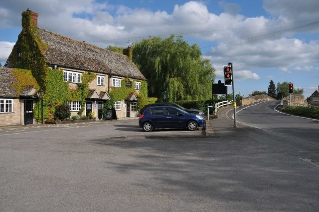
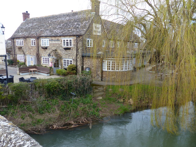
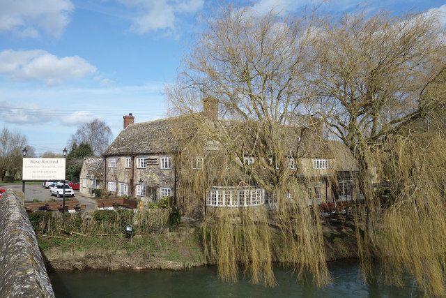
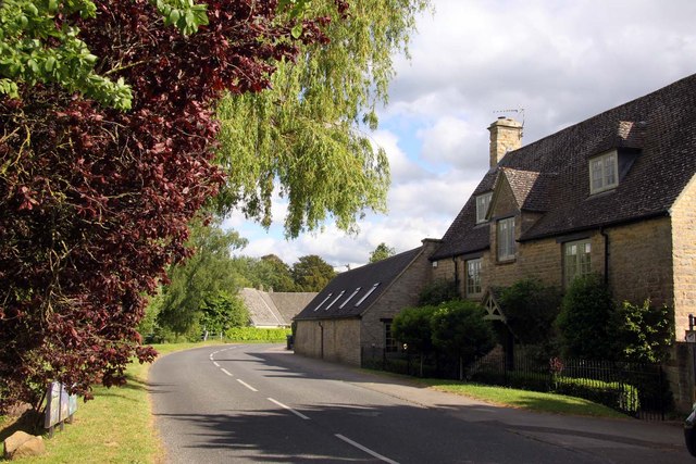
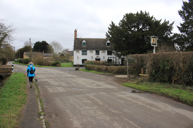
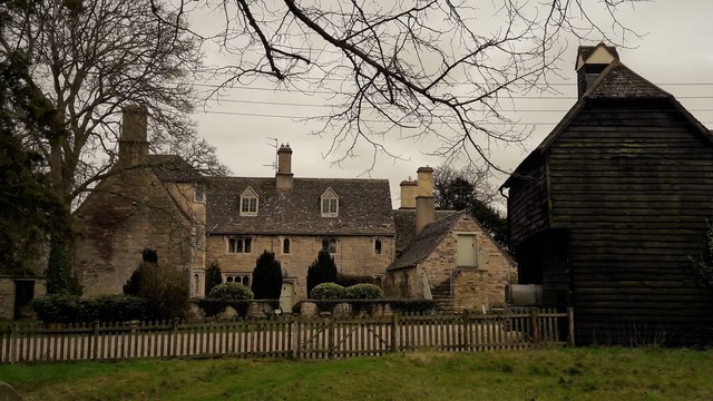
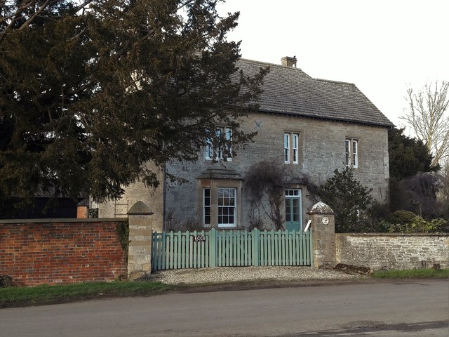
House, Pub, Public, Public House 51.70961, -1.41741 0.61 kms (E)
-
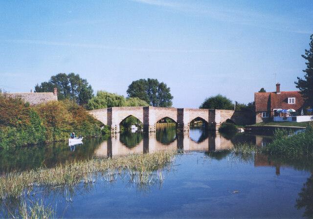
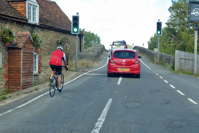
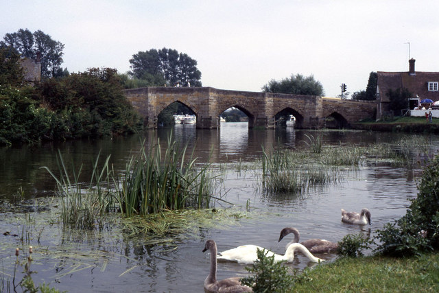
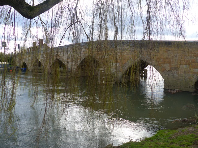
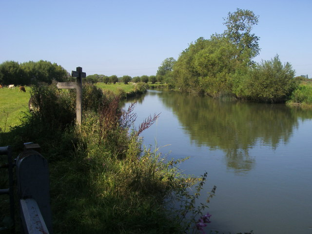
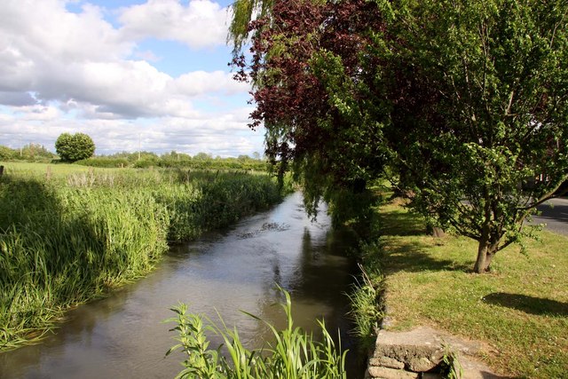
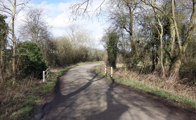
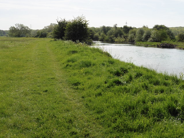
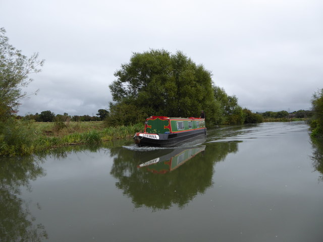
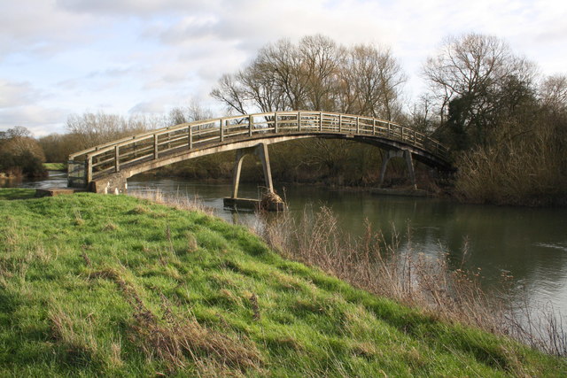
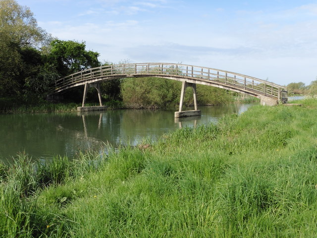
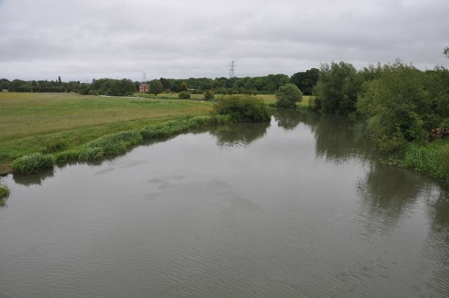
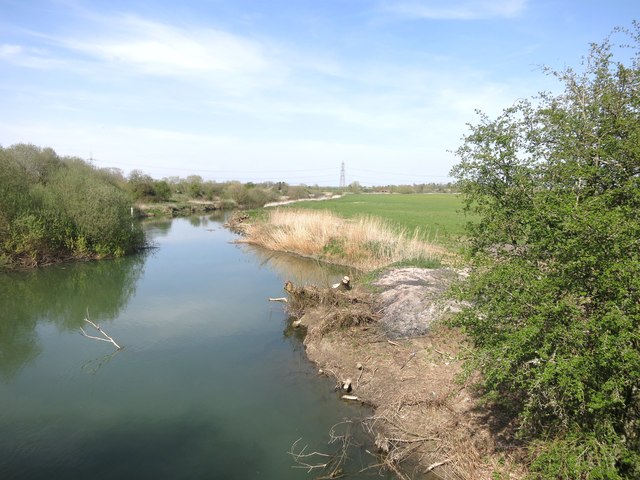
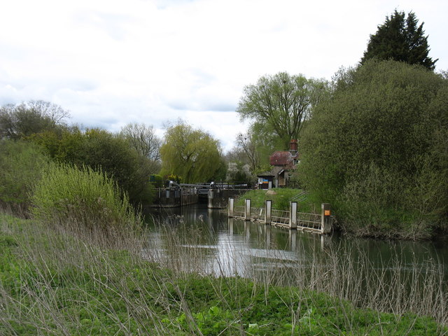
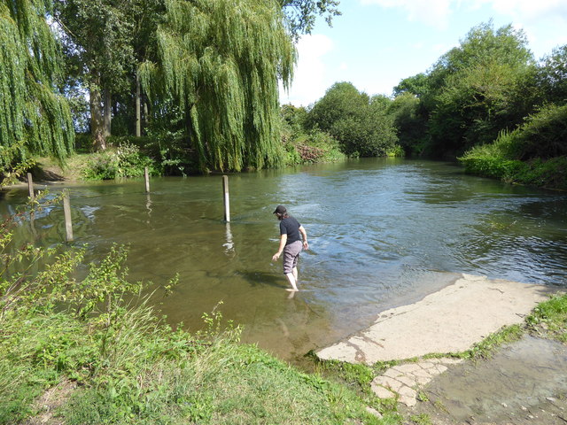
River, Road Bridge 51.71, -1.41722 0.63 kms (E)
-
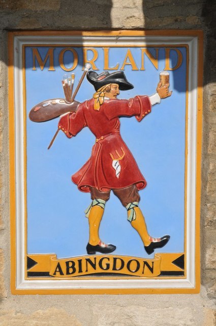
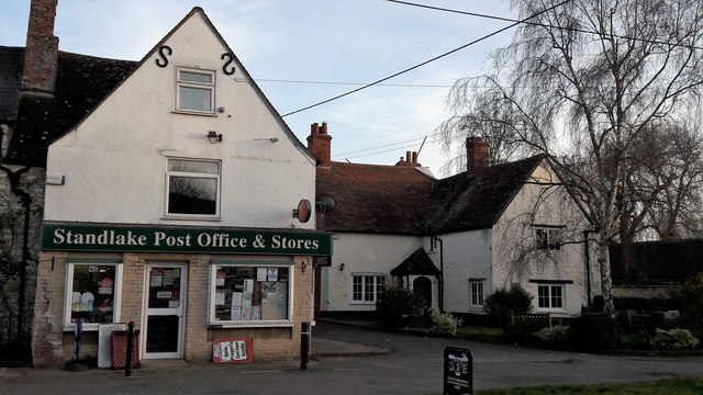
Pub 51.71032, -1.41679 0.66 kms (E) Northmoor West Oxfordshire Oxfordshire South East England United Kingdom
-
Administrative, Civil Parish, Village 51.72716, -1.42416 1.97 kms (N) West Oxfordshire Oxfordshire South East England United Kingdom
-
Administrative, Hamlet 51.71071, -1.40587 1.41 kms (E) Northmoor West Oxfordshire Oxfordshire South East England United Kingdom
-
Administrative, Civil Parish, Village 51.69209, -1.43792 2.09 kms (SSW) Vale of White Horse Oxfordshire South East England United Kingdom
-
Village 51.68179, -1.41354 3.2 kms (SSE) Vale of White Horse Oxfordshire South East England United Kingdom
-
Administrative, Civil Parish, Village 51.72251, -1.3921 2.76 kms (ENE) Northmoor West Oxfordshire Oxfordshire South East England United Kingdom
-
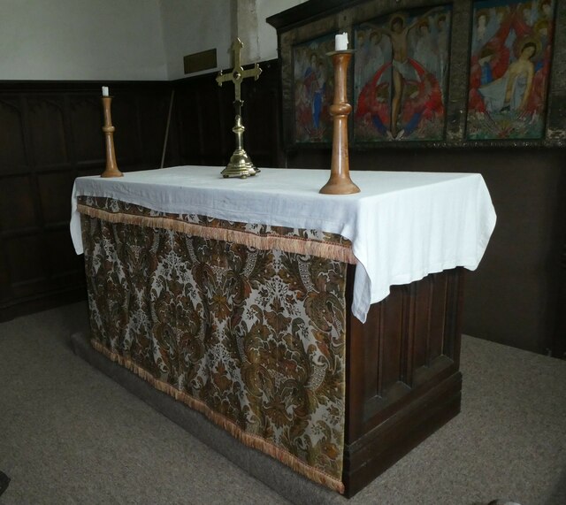
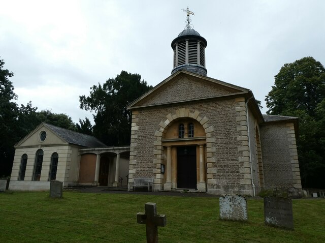
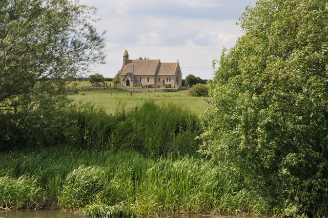
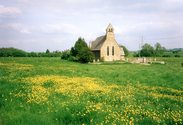
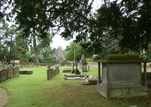
Place of Worship 51.71519, -1.46314 2.62 kms (WNW) Aston, Cote, Shifford and Chimney West Oxfordshire Oxfordshire South East England United Kingdom
-
Administrative, Civil Parish, Village 51.68891, -1.45798 3.16 kms (SW) Vale of White Horse Oxfordshire South East England United Kingdom
-
Village 51.68723, -1.39151 3.44 kms (SE) Vale of White Horse Oxfordshire South East England United Kingdom
-
Administrative, Civil Parish, Village 51.74796, -1.40395 4.55 kms (NNE) Stanton Harcourt West Oxfordshire Oxfordshire South East England United Kingdom
51.70948,-1.42626 10/05/2018 Dave Kelly CC BY-SA 2.0 0 kms (N)
51.70949,-1.4264 05/09/2012 Shaun Ferguson CC BY-SA 2.0 0.01 kms (W)
51.70966,-1.42524 21/05/2011 Philip Halling CC BY-SA 2.0 0.07 kms (ENE)
51.70879,-1.43061 25/04/2016 David Purchase CC BY-SA 2.0 0.31 kms (WSW)
51.70852,-1.43076 28/10/2009 Chris Gunns CC BY-SA 2.0 0.33 kms (WSW)
51.71379,-1.42389 04/02/2016 Roger Templeman CC BY-SA 2.0 0.51 kms (NNE)
51.71406,-1.42432 30/05/2021 Vieve Forward CC BY-SA 2.0 0.53 kms (NNE)
51.70708,-1.43063 06/05/2013 Dave Price CC BY-SA 2.0 0.4 kms (SW)
51.7087,-1.43119 21/05/2011 Philip Halling CC BY-SA 2.0 0.35 kms (WSW)
51.70953,-1.41801 02/03/2017 Des Blenkinsopp CC BY-SA 2.0 0.57 kms (E)
51.7098,-1.41757 01/01/1970 Des Blenkinsopp CC BY-SA 2.0 0.6 kms (E)
51.70998,-1.41757 17/03/2019 Ruth Sharville CC BY-SA 2.0 0.6 kms (E)
51.71016,-1.41742 21/05/2011 Philip Halling CC BY-SA 2.0 0.61 kms (E)
51.71016,-1.41742 21/05/2011 Philip Halling CC BY-SA 2.0 0.61 kms (E)
51.7098,-1.41728 22/08/2020 Robin Webster CC BY-SA 2.0 0.62 kms (E)
51.70989,-1.41728 30/08/1987 Colin Park CC BY-SA 2.0 0.62 kms (E)
51.7098,-1.41713 17/03/2019 Ruth Sharville CC BY-SA 2.0 0.63 kms (E)
51.71007,-1.41699 17/03/2019 Ruth Sharville CC BY-SA 2.0 0.64 kms (E)
51.71016,-1.41699 02/03/2017 Des Blenkinsopp CC BY-SA 2.0 0.64 kms (E)
51.708,-1.43554 21/05/2011 Philip Halling CC BY-SA 2.0 0.66 kms (WSW)
51.71456,-1.43444 25/07/2018 Des Blenkinsopp CC BY-SA 2.0 0.8 kms (NW)
51.71429,-1.43517 25/07/2018 Des Blenkinsopp CC BY-SA 2.0 0.81 kms (NW)
51.71205,-1.43679 25/07/2018 Des Blenkinsopp CC BY-SA 2.0 0.78 kms (WNW)
51.71313,-1.43663 27/10/2009 Chris Gunns CC BY-SA 2.0 0.82 kms (WNW)
51.70898,-1.41526 02/03/2017 Des Blenkinsopp CC BY-SA 2.0 0.76 kms (E)
51.70979,-1.41525 11/05/2018 Dave Kelly CC BY-SA 2.0 0.76 kms (E)
51.71403,-1.43677 25/07/2018 Des Blenkinsopp CC BY-SA 2.0 0.88 kms (NW)
51.70783,-1.438 10/05/2018 Dave Kelly CC BY-SA 2.0 0.83 kms (WSW)
51.7082,-1.43843 21/05/2011 Philip Halling CC BY-SA 2.0 0.85 kms (W)
51.70963,-1.43856 25/04/2016 David Purchase CC BY-SA 2.0 0.85 kms (W)
51.70793,-1.43872 15/08/2019 Vieve Forward CC BY-SA 2.0 0.88 kms (WSW)
51.70874,-1.439 21/05/2011 Philip Halling CC BY-SA 2.0 0.88 kms (W)
51.70901,-1.43914 05/09/2012 Shaun Ferguson CC BY-SA 2.0 0.89 kms (W)
51.71315,-1.44039 25/07/2018 Des Blenkinsopp CC BY-SA 2.0 1.06 kms (WNW)
51.72495,-1.42679 24/02/2017 Chris Brown CC BY-SA 2.0 1.72 kms (N)
51.72576,-1.42547 24/02/2017 Chris Brown CC BY-SA 2.0 1.81 kms (N)
51.72602,-1.42532 24/02/2017 Chris Brown CC BY-SA 2.0 1.84 kms (N)
51.70868,-1.40904 28/05/2011 Philip Halling CC BY-SA 2.0 1.19 kms (E)
51.7271,-1.42459 22/07/2014 Des Blenkinsopp CC BY-SA 2.0 1.96 kms (N)
51.72682,-1.42271 30/05/2021 Vieve Forward CC BY-SA 2.0 1.94 kms (N)
51.70894,-1.40774 28/05/2011 Philip Halling CC BY-SA 2.0 1.28 kms (E)
51.71407,-1.44444 25/07/2018 Des Blenkinsopp CC BY-SA 2.0 1.35 kms (WNW)
51.71281,-1.44518 12/12/2010 Bill Nicholls CC BY-SA 2.0 1.35 kms (WNW)
51.71308,-1.44532 12/12/2010 Bill Nicholls CC BY-SA 2.0 1.37 kms (WNW)
51.71314,-1.44532 12/12/2010 Bill Nicholls CC BY-SA 2.0 1.37 kms (WNW)
51.71316,-1.44534 12/12/2010 Bill Nicholls CC BY-SA 2.0 1.38 kms (WNW)
51.71317,-1.44546 12/12/2010 Bill Nicholls CC BY-SA 2.0 1.39 kms (WNW)
51.71308,-1.44561 12/12/2010 Bill Nicholls CC BY-SA 2.0 1.39 kms (WNW)
51.7101,-1.40613 04/02/2016 Roger Templeman CC BY-SA 2.0 1.39 kms (E)
51.7101,-1.40599 04/02/2016 Roger Templeman CC BY-SA 2.0 1.4 kms (E)
51.71019,-1.40599 11/03/2014 Steve Daniels CC BY-SA 2.0 1.4 kms (E)
51.7298,-1.42557 22/07/2014 Des Blenkinsopp CC BY-SA 2.0 2.26 kms (N)
51.72989,-1.42614 24/02/2017 Chris Brown CC BY-SA 2.0 2.27 kms (N)
51.7299,-1.42629 24/02/2017 Chris Brown CC BY-SA 2.0 2.27 kms (N)
51.7299,-1.42629 13/06/2013 Steve Daniels CC BY-SA 2.0 2.27 kms (N)
51.72998,-1.42585 13/06/2013 Steve Daniels CC BY-SA 2.0 2.28 kms (N)
51.72998,-1.42542 13/06/2013 Steve Daniels CC BY-SA 2.0 2.28 kms (N)
51.73007,-1.42556 13/06/2013 Steve Daniels CC BY-SA 2.0 2.29 kms (N)
51.7121,-1.44692 21/05/2011 Philip Halling CC BY-SA 2.0 1.45 kms (W)
51.71118,-1.40539 11/03/2014 Steve Daniels CC BY-SA 2.0 1.45 kms (E)
51.71235,-1.40509 02/03/2017 Des Blenkinsopp CC BY-SA 2.0 1.49 kms (ENE)
51.70812,-1.40471 28/05/2011 Philip Halling CC BY-SA 2.0 1.49 kms (E)
51.73106,-1.42483 22/07/2014 Des Blenkinsopp CC BY-SA 2.0 2.4 kms (N)
51.71297,-1.40349 02/03/2017 Des Blenkinsopp CC BY-SA 2.0 1.62 kms (ENE)
51.70775,-1.40327 28/05/2011 Philip Halling CC BY-SA 2.0 1.6 kms (E)
51.68636,-1.4225 17/07/2019 Vieve Forward CC BY-SA 2.0 2.58 kms (S)
51.70775,-1.40269 04/02/2016 Roger Templeman CC BY-SA 2.0 1.64 kms (E)
51.70775,-1.40269 04/02/2016 Roger Templeman CC BY-SA 2.0 1.64 kms (E)
51.70738,-1.40139 28/05/2011 Philip Halling CC BY-SA 2.0 1.73 kms (E)
51.69268,-1.44586 31/07/2021 Basher Eyre CC BY-SA 2.0 2.31 kms (SW)
51.69268,-1.44586 31/07/2021 Basher Eyre CC BY-SA 2.0 2.31 kms (SW)
51.69268,-1.44586 31/07/2021 Basher Eyre CC BY-SA 2.0 2.31 kms (SW)
51.69268,-1.44586 31/07/2021 Basher Eyre CC BY-SA 2.0 2.31 kms (SW)
51.69268,-1.44586 31/07/2021 Basher Eyre CC BY-SA 2.0 2.31 kms (SW)
51.69268,-1.44586 31/07/2021 Basher Eyre CC BY-SA 2.0 2.31 kms (SW)
51.69268,-1.44586 31/07/2021 Basher Eyre CC BY-SA 2.0 2.31 kms (SW)
51.69268,-1.44586 31/07/2021 Basher Eyre CC BY-SA 2.0 2.31 kms (SW)
51.69268,-1.44586 31/07/2021 Basher Eyre CC BY-SA 2.0 2.31 kms (SW)
51.69268,-1.44586 31/07/2021 Basher Eyre CC BY-SA 2.0 2.31 kms (SW)
51.69268,-1.44586 31/07/2021 Basher Eyre CC BY-SA 2.0 2.31 kms (SW)
51.69268,-1.44586 31/07/2021 Basher Eyre CC BY-SA 2.0 2.31 kms (SW)
51.69268,-1.44586 31/07/2021 Basher Eyre CC BY-SA 2.0 2.31 kms (SW)

51.69268,-1.44586 31/07/2021 Basher Eyre CC BY-SA 2.0 2.31 kms (SW)
51.69268,-1.44586 31/07/2021 Basher Eyre CC BY-SA 2.0 2.31 kms (SW)
51.68568,-1.41282 10/08/2019 David Howard CC BY-SA 2.0 2.8 kms (SSE)
51.68568,-1.41267 10/08/2019 David Howard CC BY-SA 2.0 2.81 kms (SSE)
51.71267,-1.45401 21/05/2011 Philip Halling CC BY-SA 2.0 1.94 kms (W)
51.68354,-1.4153 28/05/2020 Des Blenkinsopp CC BY-SA 2.0 2.98 kms (SSE)
51.683,-1.41502 28/05/2020 Des Blenkinsopp CC BY-SA 2.0 3.05 kms (SSE)
51.68299,-1.41473 28/05/2020 Des Blenkinsopp CC BY-SA 2.0 3.05 kms (SSE)
51.70664,-1.3972 11/05/2018 Dave Kelly CC BY-SA 2.0 2.03 kms (E)
51.68325,-1.41285 22/08/2020 Robin Webster CC BY-SA 2.0 3.06 kms (SSE)
51.68397,-1.41139 28/05/2020 Des Blenkinsopp CC BY-SA 2.0 3.02 kms (SSE)
51.68112,-1.41721 01/01/1970 Milestone Society CC BY-SA 2.0 3.22 kms (SSE)
51.68226,-1.41272 10/09/2019 David Howard CC BY-SA 2.0 3.17 kms (SSE)
51.72382,-1.45329 07/04/2007 David Luther Thomas CC BY-SA 2.0 2.45 kms (NW)
51.68378,-1.40922 28/05/2020 Des Blenkinsopp CC BY-SA 2.0 3.09 kms (SSE)
51.70636,-1.39533 24/04/2016 David Purchase CC BY-SA 2.0 2.16 kms (E)
51.72409,-1.45372 09/11/2019 David Howard CC BY-SA 2.0 2.49 kms (NW)
51.68386,-1.4085 28/05/2020 Des Blenkinsopp CC BY-SA 2.0 3.1 kms (SSE)
51.71359,-1.45747 01/01/1970 Stuart Logan CC BY-SA 2.0 2.2 kms (W)
51.70663,-1.39445 06/09/2016 Vieve Forward CC BY-SA 2.0 2.21 kms (E)
51.6802,-1.41245 31/07/2021 Basher Eyre CC BY-SA 2.0 3.39 kms (SSE)
51.68001,-1.41202 31/07/2021 Basher Eyre CC BY-SA 2.0 3.42 kms (SSE)

51.68001,-1.41202 31/07/2021 Basher Eyre CC BY-SA 2.0 3.42 kms (SSE)
51.70599,-1.3936 27/02/2017 Nigel Mykura CC BY-SA 2.0 2.28 kms (E)
51.70662,-1.39344 04/02/2016 Roger Templeman CC BY-SA 2.0 2.28 kms (E)
51.71504,-1.45904 15/08/2019 Vieve Forward CC BY-SA 2.0 2.34 kms (WNW)
51.71827,-1.45843 09/06/2014 Des Blenkinsopp CC BY-SA 2.0 2.42 kms (WNW)
51.7068,-1.39301 11/05/2018 Dave Kelly CC BY-SA 2.0 2.31 kms (E)
51.70365,-1.3929 28/05/2011 Philip Halling CC BY-SA 2.0 2.39 kms (ESE)
51.70653,-1.39243 28/05/2011 Philip Halling CC BY-SA 2.0 2.35 kms (E)
51.71264,-1.39235 20/09/2020 Des Blenkinsopp CC BY-SA 2.0 2.36 kms (E)
51.70518,-1.39245 16/07/2019 Vieve Forward CC BY-SA 2.0 2.38 kms (E)
51.70203,-1.39249 25/04/2010 Bill Nicholls CC BY-SA 2.0 2.47 kms (ESE)
51.71858,-1.39256 20/09/2020 Des Blenkinsopp CC BY-SA 2.0 2.53 kms (ENE)
51.72299,-1.39322 19/02/2017 Chris Brown CC BY-SA 2.0 2.73 kms (NE)
51.7229,-1.39308 25/02/2017 Nigel Mykura CC BY-SA 2.0 2.73 kms (NE)
51.70328,-1.39074 30/12/2009 Shaun Ferguson CC BY-SA 2.0 2.54 kms (ESE)
51.72071,-1.46057 09/06/2014 Des Blenkinsopp CC BY-SA 2.0 2.67 kms (WNW)
51.71909,-1.46117 17/10/2009 andrew auger CC BY-SA 2.0 2.63 kms (WNW)
51.71227,-1.39004 20/09/2020 Des Blenkinsopp CC BY-SA 2.0 2.51 kms (E)
51.71361,-1.46253 09/06/2014 Des Blenkinsopp CC BY-SA 2.0 2.54 kms (W)
51.72161,-1.4607 23/01/2007 Jonathan Billinger CC BY-SA 2.0 2.73 kms (WNW)
51.72107,-1.461 05/12/2009 andrew auger CC BY-SA 2.0 2.72 kms (WNW)
51.72134,-1.461 27/05/2021 Vieve Forward CC BY-SA 2.0 2.73 kms (WNW)
51.72289,-1.39207 19/02/2017 Chris Brown CC BY-SA 2.0 2.79 kms (ENE)
51.72298,-1.39206 19/02/2017 Chris Brown CC BY-SA 2.0 2.79 kms (ENE)
51.72298,-1.39178 19/02/2017 Chris Brown CC BY-SA 2.0 2.81 kms (ENE)
51.72271,-1.39163 01/02/2018 Chris Brown CC BY-SA 2.0 2.8 kms (ENE)
51.71496,-1.46295 21/05/2011 Philip Halling CC BY-SA 2.0 2.6 kms (WNW)
51.70831,-1.46347 15/04/2015 Des Blenkinsopp CC BY-SA 2.0 2.57 kms (W)
51.71487,-1.4631 05/09/2012 Shaun Ferguson CC BY-SA 2.0 2.61 kms (WNW)
51.72253,-1.39135 19/02/2017 Chris Brown CC BY-SA 2.0 2.81 kms (ENE)
51.72271,-1.3912 01/02/2018 Chris Brown CC BY-SA 2.0 2.83 kms (ENE)
51.72386,-1.46125 09/11/2019 David Howard CC BY-SA 2.0 2.89 kms (WNW)
51.70786,-1.38836 28/05/2011 Philip Halling CC BY-SA 2.0 2.62 kms (E)
51.70692,-1.46416 26/07/2020 Jim Champion CC BY-SA 2.0 2.63 kms (W)
51.71254,-1.46428 07/05/2021 Vieve Forward CC BY-SA 2.0 2.64 kms (W)
51.6895,-1.45877 31/07/2021 Basher Eyre CC BY-SA 2.0 3.16 kms (SW)
51.6895,-1.45877 31/07/2021 Basher Eyre CC BY-SA 2.0 3.16 kms (SW)
51.6895,-1.45877 31/07/2021 Basher Eyre CC BY-SA 2.0 3.16 kms (SW)
51.6895,-1.45877 31/07/2021 Basher Eyre CC BY-SA 2.0 3.16 kms (SW)

51.6895,-1.45877 31/07/2021 Basher Eyre CC BY-SA 2.0 3.16 kms (SW)
51.71641,-1.4638 17/10/2009 andrew auger CC BY-SA 2.0 2.7 kms (WNW)
51.72413,-1.46154 17/10/2009 andrew auger CC BY-SA 2.0 2.93 kms (WNW)
51.68941,-1.45877 31/07/2021 Basher Eyre CC BY-SA 2.0 3.16 kms (SW)
51.68941,-1.45877 31/07/2021 Basher Eyre CC BY-SA 2.0 3.16 kms (SW)
51.68941,-1.45877 31/07/2021 Basher Eyre CC BY-SA 2.0 3.16 kms (SW)

51.68941,-1.45877 31/07/2021 Basher Eyre CC BY-SA 2.0 3.16 kms (SW)
51.68941,-1.45877 31/07/2021 Basher Eyre CC BY-SA 2.0 3.16 kms (SW)
51.68941,-1.45877 31/07/2021 Basher Eyre CC BY-SA 2.0 3.16 kms (SW)
51.68941,-1.45877 31/07/2021 Basher Eyre CC BY-SA 2.0 3.16 kms (SW)
51.68941,-1.45877 31/07/2021 Basher Eyre CC BY-SA 2.0 3.16 kms (SW)
51.68941,-1.45877 31/07/2021 Basher Eyre CC BY-SA 2.0 3.16 kms (SW)
51.68941,-1.45877 31/07/2021 Basher Eyre CC BY-SA 2.0 3.16 kms (SW)
51.72314,-1.46199 02/07/2009 andrew auger CC BY-SA 2.0 2.89 kms (WNW)
51.70688,-1.4645 10/05/2018 Dave Kelly CC BY-SA 2.0 2.65 kms (W)
51.71506,-1.46425 01/01/1970 Des Blenkinsopp CC BY-SA 2.0 2.69 kms (WNW)
51.72387,-1.39046 01/02/2018 Chris Brown CC BY-SA 2.0 2.94 kms (ENE)
51.70697,-1.46478 25/04/2016 David Purchase CC BY-SA 2.0 2.67 kms (W)
51.71641,-1.46438 11/08/2006 Rick Hall CC BY-SA 2.0 2.74 kms (WNW)
51.72396,-1.38988 20/09/2020 Des Blenkinsopp CC BY-SA 2.0 2.98 kms (ENE)
51.70706,-1.46551 15/04/2015 Des Blenkinsopp CC BY-SA 2.0 2.72 kms (W)
51.70048,-1.38788 25/04/2010 Bill Nicholls CC BY-SA 2.0 2.83 kms (ESE)
51.7148,-1.46556 27/05/2021 Vieve Forward CC BY-SA 2.0 2.77 kms (WNW)
51.70021,-1.38745 25/04/2010 Bill Nicholls CC BY-SA 2.0 2.87 kms (ESE)
51.70865,-1.38632 28/05/2011 Philip Halling CC BY-SA 2.0 2.75 kms (E)
51.7157,-1.46584 05/12/2009 andrew auger CC BY-SA 2.0 2.81 kms (WNW)
51.68558,-1.39358 31/07/2021 Basher Eyre CC BY-SA 2.0 3.48 kms (SE)
51.69879,-1.46618 11/03/2014 Steve Daniels CC BY-SA 2.0 3 kms (WSW)
51.69804,-1.38647 25/04/2010 Bill Nicholls CC BY-SA 2.0 3.02 kms (ESE)
51.69843,-1.46619 15/08/2019 Vieve Forward CC BY-SA 2.0 3.01 kms (WSW)
51.68709,-1.38965 31/07/2021 Basher Eyre CC BY-SA 2.0 3.54 kms (SE)
51.68718,-1.38893 31/07/2021 Basher Eyre CC BY-SA 2.0 3.57 kms (SE)
51.68718,-1.38893 31/07/2021 Basher Eyre CC BY-SA 2.0 3.57 kms (SE)
51.68718,-1.38893 31/07/2021 Basher Eyre CC BY-SA 2.0 3.57 kms (SE)
51.68718,-1.38893 31/07/2021 Basher Eyre CC BY-SA 2.0 3.57 kms (SE)
51.68718,-1.38893 31/07/2021 Basher Eyre CC BY-SA 2.0 3.57 kms (SE)
51.68718,-1.38893 31/07/2021 Basher Eyre CC BY-SA 2.0 3.57 kms (SE)
51.68718,-1.38893 31/07/2021 Basher Eyre CC BY-SA 2.0 3.57 kms (SE)
51.68718,-1.38893 31/07/2021 Basher Eyre CC BY-SA 2.0 3.57 kms (SE)
51.687,-1.38879 31/07/2021 Basher Eyre CC BY-SA 2.0 3.59 kms (SE)
51.74895,-1.40722 25/03/2017 Chris Brown CC BY-SA 2.0 4.58 kms (NNE)
51.6835,-1.39057 01/11/2019 Vieve Forward CC BY-SA 2.0 3.79 kms (SE)
51.68601,-1.38865 31/07/2021 Basher Eyre CC BY-SA 2.0 3.68 kms (SE)
51.74639,-1.39928 25/03/2017 Chris Brown CC BY-SA 2.0 4.5 kms (NNE)
51.74757,-1.39985 25/03/2017 Chris Brown CC BY-SA 2.0 4.61 kms (NNE)
51.74784,-1.39984 25/03/2017 Chris Brown CC BY-SA 2.0 4.64 kms (NNE)
51.74747,-1.39883 25/03/2017 Chris Brown CC BY-SA 2.0 4.63 kms (NNE)
51.74738,-1.39869 25/03/2017 Chris Brown CC BY-SA 2.0 4.62 kms (NNE)
51.74937,-1.40142 25/03/2017 Chris Brown CC BY-SA 2.0 4.75 kms (NNE)
51.74819,-1.39911 25/03/2017 Chris Brown CC BY-SA 2.0 4.69 kms (NNE)
51.74783,-1.39839 25/03/2017 Chris Brown CC BY-SA 2.0 4.68 kms (NNE)
51.74783,-1.39825 25/03/2017 Chris Brown CC BY-SA 2.0 4.68 kms (NNE)
51.74792,-1.39781 25/03/2017 Chris Brown CC BY-SA 2.0 4.7 kms (NNE)
51.748,-1.39781 25/03/2017 Chris Brown CC BY-SA 2.0 4.71 kms (NNE)
51.748,-1.39781 25/03/2017 Chris Brown CC BY-SA 2.0 4.71 kms (NNE)
51.748,-1.39767 25/03/2017 Chris Brown CC BY-SA 2.0 4.71 kms (NNE)
51.748,-1.39767 25/03/2017 Chris Brown CC BY-SA 2.0 4.71 kms (NNE)