-
Administrative, Town 51.44431, 0.21807 0.98 kms (SSE) Kent South East England United Kingdom
-
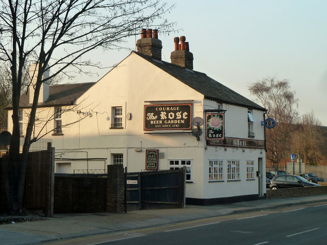
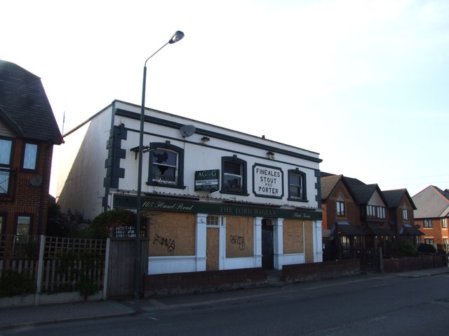
Pub 51.46993, 0.19303 2.42 kms (NW)
-
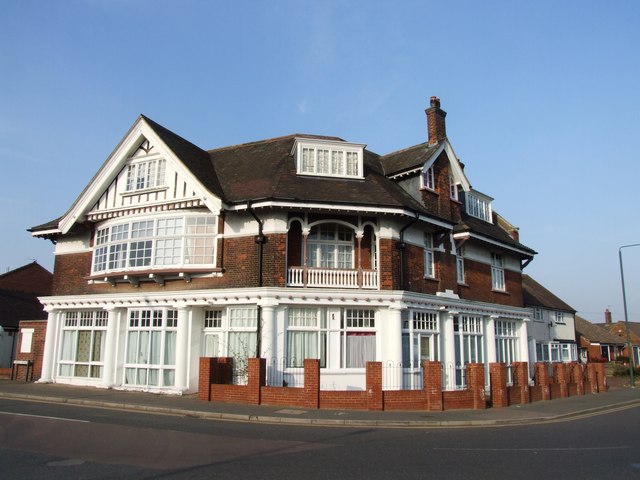
Pub 51.47145, 0.19328 2.55 kms (NW)
-
Cape 51.48285, 0.21117 3.33 kms (N) London Borough of Bexley London Greater London United Kingdom
-
Pub 51.45221, 0.17847 2.53 kms (W)
-
Pub 51.45182, 0.17792 2.57 kms (W)
-
Village 51.48168, 0.23955 3.62 kms (NNE) Essex East of England United Kingdom
-
Pub 51.45271, 0.17697 2.63 kms (W)
-
Pub 51.45299, 0.17657 2.66 kms (W)
-
Pub 51.47847, 0.18617 3.47 kms (NW)
-
Pub 51.47349, 0.18151 3.26 kms (NW)
-
Pub 51.48099, 0.18139 3.89 kms (NW)
-
Pub 51.48127, 0.18135 3.92 kms (NW)
-
Lighthouse, Point 51.48799, 0.18784 4.33 kms (NNW) London Borough of Havering London Greater London United Kingdom
-
Pub 51.48202, 0.17967 4.05 kms (NW)
51.45295,0.215 24/04/2020 Claire Stretch CC BY-SA 2.0 0 kms (N)
51.45221,0.21612 24/04/2020 Claire Stretch CC BY-SA 2.0 0.11 kms (SE)
51.44811,0.21894 13/11/2019 John Baker CC BY-SA 2.0 0.6 kms (SSE)
51.45086,0.22109 01/03/2012 Robin Webster CC BY-SA 2.0 0.48 kms (ESE)
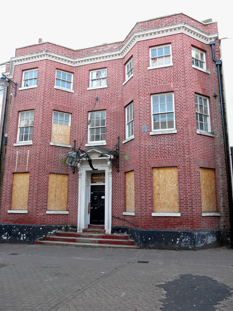
51.44437,0.21732 07/07/2020 Paul Williams CC BY-SA 2.0 0.97 kms (S)
51.44436,0.21746 07/07/2020 Paul Williams CC BY-SA 2.0 0.97 kms (S)
51.44427,0.2176 07/07/2020 Paul Williams CC BY-SA 2.0 0.98 kms (S)
51.44426,0.21832 07/07/2020 Paul Williams CC BY-SA 2.0 0.99 kms (SSE)
51.44408,0.21802 07/07/2020 Paul Williams CC BY-SA 2.0 1.01 kms (SSE)
51.45143,0.22443 01/03/2012 Robin Webster CC BY-SA 2.0 0.67 kms (ESE)
51.44407,0.21889 07/07/2020 Paul Williams CC BY-SA 2.0 1.02 kms (SSE)
51.44415,0.21932 13/11/2019 John Baker CC BY-SA 2.0 1.02 kms (SSE)
51.44519,0.22124 01/03/2012 Robin Webster CC BY-SA 2.0 0.97 kms (SSE)
51.44397,0.21931 13/11/2019 John Baker CC BY-SA 2.0 1.04 kms (SSE)
51.46254,0.21215 01/03/2012 Robin Webster CC BY-SA 2.0 1.08 kms (N)
51.4624,0.20999 29/03/2014 Chris Whippet CC BY-SA 2.0 1.11 kms (NNW)
51.4633,0.21003 23/10/2016 Chris Heaton CC BY-SA 2.0 1.2 kms (NNW)
51.46531,0.21286 01/03/2012 Robin Webster CC BY-SA 2.0 1.38 kms (N)
51.46532,0.21243 04/06/2015 Des Blenkinsopp CC BY-SA 2.0 1.39 kms (N)
51.46568,0.21274 01/03/2012 Robin Webster CC BY-SA 2.0 1.42 kms (N)
51.46814,0.21559 16/04/2014 Chris Whippet CC BY-SA 2.0 1.69 kms (N)
51.46904,0.21535 22/04/2017 Glyn Baker CC BY-SA 2.0 1.79 kms (N)
51.46929,0.2119 22/04/2017 Glyn Baker CC BY-SA 2.0 1.83 kms (N)
51.46836,0.20869 04/06/2015 Des Blenkinsopp CC BY-SA 2.0 1.77 kms (NNW)
51.46988,0.2092 23/10/2016 Chris Heaton CC BY-SA 2.0 1.92 kms (NNW)
51.46989,0.20876 29/03/2014 Chris Whippet CC BY-SA 2.0 1.93 kms (NNW)
51.47238,0.21479 04/06/2015 Des Blenkinsopp CC BY-SA 2.0 2.16 kms (N)
51.47216,0.21204 01/03/2012 Robin Webster CC BY-SA 2.0 2.15 kms (N)
51.47237,0.21076 22/04/2017 Glyn Baker CC BY-SA 2.0 2.18 kms (N)
51.47178,0.20857 23/10/2016 Chris Heaton CC BY-SA 2.0 2.14 kms (NNW)

51.47382,0.21025 08/07/2006 Stephen Craven CC BY-SA 2.0 2.34 kms (N)
51.4737,0.20693 04/06/2015 Des Blenkinsopp CC BY-SA 2.0 2.37 kms (NNW)
51.47512,0.21276 22/04/2017 Glyn Baker CC BY-SA 2.0 2.47 kms (N)
51.47515,0.21118 04/06/2015 Des Blenkinsopp CC BY-SA 2.0 2.48 kms (N)
51.47563,0.21423 22/04/2017 Glyn Baker CC BY-SA 2.0 2.52 kms (N)
51.47501,0.20916 01/03/2012 Robin Webster CC BY-SA 2.0 2.49 kms (N)
51.47453,0.20568 09/08/2014 David Martin CC BY-SA 2.0 2.48 kms (NNW)
51.47323,0.20302 09/08/2014 David Martin CC BY-SA 2.0 2.4 kms (NNW)
51.47247,0.20082 09/08/2014 David Martin CC BY-SA 2.0 2.38 kms (NNW)
51.46762,0.19555 17/04/2006 A Marston CC BY-SA 2.0 2.12 kms (NW)
51.47449,0.20294 09/08/2014 David Martin CC BY-SA 2.0 2.54 kms (NNW)
51.47205,0.19922 09/08/2014 David Martin CC BY-SA 2.0 2.39 kms (NNW)
51.4782,0.21608 23/10/2016 Chris Heaton CC BY-SA 2.0 2.81 kms (N)
51.46571,0.192 23/04/2017 Glyn Baker CC BY-SA 2.0 2.13 kms (NW)
51.4735,0.23183 07/11/2021 David Martin CC BY-SA 2.0 2.56 kms (NNE)
51.4734,0.23226 16/04/2014 Chris Whippet CC BY-SA 2.0 2.57 kms (NNE)
51.46768,0.1921 29/03/2014 Chris Whippet CC BY-SA 2.0 2.28 kms (NW)
51.46724,0.1915 29/03/2014 Chris Whippet CC BY-SA 2.0 2.27 kms (NW)
51.46982,0.19307 29/03/2014 Chris Whippet CC BY-SA 2.0 2.41 kms (NW)
51.46734,0.19108 29/03/2014 Chris Whippet CC BY-SA 2.0 2.3 kms (NW)
51.47853,0.20328 04/06/2015 Des Blenkinsopp CC BY-SA 2.0 2.96 kms (NNW)
51.48068,0.20885 23/04/2017 Glyn Baker CC BY-SA 2.0 3.11 kms (N)
51.48158,0.21365 23/10/2016 Chris Heaton CC BY-SA 2.0 3.18 kms (N)
51.46754,0.19008 21/08/2013 N Chadwick CC BY-SA 2.0 2.37 kms (NW)
51.4687,0.19071 29/03/2014 Chris Whippet CC BY-SA 2.0 2.43 kms (NW)
51.468,0.18981 23/04/2017 Glyn Baker CC BY-SA 2.0 2.42 kms (NW)

51.48233,0.2121 04/06/2015 Des Blenkinsopp CC BY-SA 2.0 3.27 kms (N)
51.46711,0.1889 29/03/2014 Chris Whippet CC BY-SA 2.0 2.4 kms (NW)
51.48252,0.21125 23/04/2017 Glyn Baker CC BY-SA 2.0 3.3 kms (N)
51.48252,0.21125 23/04/2017 Glyn Baker CC BY-SA 2.0 3.3 kms (N)
51.44852,0.24458 12/04/2011 Marathon CC BY-SA 2.0 2.11 kms (ESE)
51.48121,0.20456 04/06/2015 Des Blenkinsopp CC BY-SA 2.0 3.22 kms (NNW)
51.47888,0.19941 04/06/2015 Des Blenkinsopp CC BY-SA 2.0 3.08 kms (NNW)

51.47449,0.19372 09/08/2014 David Martin CC BY-SA 2.0 2.81 kms (NNW)
51.4814,0.20385 23/10/2016 Chris Heaton CC BY-SA 2.0 3.26 kms (NNW)
51.46909,0.189 28/09/2019 Richard Vince CC BY-SA 2.0 2.54 kms (NW)
51.47741,0.19631 23/10/2016 Chris Heaton CC BY-SA 2.0 3.01 kms (NNW)
51.47977,0.19959 23/04/2017 Glyn Baker CC BY-SA 2.0 3.17 kms (NNW)
51.46936,0.18872 28/09/2019 Richard Vince CC BY-SA 2.0 2.58 kms (NW)
51.48262,0.20592 24/08/2019 Peter S CC BY-SA 2.0 3.36 kms (N)
51.46955,0.18859 28/09/2019 Richard Vince CC BY-SA 2.0 2.6 kms (NW)
51.47822,0.19606 04/06/2015 Des Blenkinsopp CC BY-SA 2.0 3.1 kms (NNW)
51.48343,0.20582 03/10/2015 Christine Matthews CC BY-SA 2.0 3.45 kms (N)
51.47179,0.1887 04/06/2014 John Salmon CC BY-SA 2.0 2.78 kms (NW)
51.44372,0.24636 04/05/2014 David Howard CC BY-SA 2.0 2.4 kms (ESE)
51.48068,0.23233 15/04/2019 Richard Rogerson CC BY-SA 2.0 3.31 kms (NNE)
51.48096,0.23206 06/11/2018 Marathon CC BY-SA 2.0 3.33 kms (NNE)
51.47764,0.1933 23/10/2016 Chris Heaton CC BY-SA 2.0 3.13 kms (NNW)
51.47738,0.19285 04/06/2015 Des Blenkinsopp CC BY-SA 2.0 3.12 kms (NNW)
51.47754,0.23707 01/10/2011 Stephen Richards CC BY-SA 2.0 3.13 kms (NNE)
51.44931,0.24813 01/01/2003 Sean Davis CC BY-SA 2.0 2.33 kms (E)

51.47661,0.23861 01/10/2011 Stephen Richards CC BY-SA 2.0 3.1 kms (NNE)
51.45277,0.18145 05/05/2020 Marathon CC BY-SA 2.0 2.32 kms (W)

51.4489,0.18156 14/07/2019 Malc McDonald CC BY-SA 2.0 2.36 kms (W)
51.4526,0.1813 05/05/2020 Marathon CC BY-SA 2.0 2.34 kms (W)
51.44782,0.24843 01/03/2012 Robin Webster CC BY-SA 2.0 2.39 kms (ESE)
51.47861,0.23741 09/09/2017 Robert Eva CC BY-SA 2.0 3.25 kms (NNE)
51.48239,0.23227 06/03/2019 Jim Osley CC BY-SA 2.0 3.49 kms (NNE)

51.48484,0.20272 23/10/2016 Chris Heaton CC BY-SA 2.0 3.65 kms (NNW)
51.4491,0.18085 14/05/2016 Richard Vince CC BY-SA 2.0 2.41 kms (W)
51.48026,0.23591 09/09/2017 Robert Eva CC BY-SA 2.0 3.36 kms (NNE)
51.44856,0.18082 14/05/2016 Richard Vince CC BY-SA 2.0 2.42 kms (WSW)
51.45018,0.18061 14/07/2019 Malc McDonald CC BY-SA 2.0 2.4 kms (W)
51.48303,0.23201 09/09/2017 Robert Eva CC BY-SA 2.0 3.55 kms (NNE)
51.47566,0.24116 01/10/2011 Stephen Richards CC BY-SA 2.0 3.11 kms (NE)
51.48089,0.23551 21/04/2017 Glyn Baker CC BY-SA 2.0 3.42 kms (NNE)
51.48089,0.23565 21/04/2017 Glyn Baker CC BY-SA 2.0 3.42 kms (NNE)
51.48079,0.23595 06/03/2019 Jim Osley CC BY-SA 2.0 3.42 kms (NNE)
51.44866,0.18039 14/05/2016 Richard Vince CC BY-SA 2.0 2.45 kms (WSW)
51.47355,0.2435 26/09/2016 David Kemp CC BY-SA 2.0 3.02 kms (NE)
51.48078,0.23694 09/09/2017 Robert Eva CC BY-SA 2.0 3.45 kms (NNE)
51.47509,0.24271 09/09/2017 Robert Eva CC BY-SA 2.0 3.12 kms (NE)
51.48679,0.20411 15/03/2012 Robin Webster CC BY-SA 2.0 3.84 kms (NNW)
51.48114,0.23667 09/09/2017 Robert Eva CC BY-SA 2.0 3.47 kms (NNE)
51.445,0.24987 01/03/2012 Robin Webster CC BY-SA 2.0 2.57 kms (ESE)
51.47781,0.18927 23/04/2017 Glyn Baker CC BY-SA 2.0 3.29 kms (NNW)
51.44384,0.24967 17/11/2013 Chris Whippet CC BY-SA 2.0 2.61 kms (ESE)
51.47471,0.24356 22/04/2017 Glyn Baker CC BY-SA 2.0 3.13 kms (NE)
51.48149,0.23698 08/10/2016 N Chadwick CC BY-SA 2.0 3.52 kms (NNE)
51.44787,0.25073 26/12/2017 Andy Clark CC BY-SA 2.0 2.54 kms (ESE)
51.45211,0.17869 04/04/2018 Jim Osley CC BY-SA 2.0 2.52 kms (W)
51.45211,0.17869 04/06/2015 Des Blenkinsopp CC BY-SA 2.0 2.52 kms (W)
51.48102,0.23811 09/06/2005 Ben Brooksbank CC BY-SA 2.0 3.51 kms (NNE)

51.44814,0.17893 14/05/2016 Richard Vince CC BY-SA 2.0 2.56 kms (WSW)
51.44383,0.25025 01/03/2012 Robin Webster CC BY-SA 2.0 2.64 kms (ESE)
51.45193,0.17839 14/07/2019 Malc McDonald CC BY-SA 2.0 2.54 kms (W)
51.45176,0.17809 04/04/2018 Jim Osley CC BY-SA 2.0 2.56 kms (W)

51.47842,0.24244 01/10/2011 Stephen Richards CC BY-SA 2.0 3.41 kms (NNE)
51.45061,0.25317 01/03/2012 Robin Webster CC BY-SA 2.0 2.66 kms (E)
51.44406,0.25227 04/05/2014 David Howard CC BY-SA 2.0 2.77 kms (ESE)
51.44621,0.25281 01/03/2012 Robin Webster CC BY-SA 2.0 2.73 kms (ESE)
51.44513,0.25261 01/03/2012 Robin Webster CC BY-SA 2.0 2.75 kms (ESE)
51.47841,0.18613 23/04/2017 Glyn Baker CC BY-SA 2.0 3.47 kms (NW)
51.46765,0.2507 09/06/2014 Tim Glover CC BY-SA 2.0 2.96 kms (NE)
51.44638,0.25311 01/03/2012 Robin Webster CC BY-SA 2.0 2.74 kms (ESE)
51.47211,0.18137 29/03/2014 Chris Whippet CC BY-SA 2.0 3.16 kms (NW)
51.44405,0.25285 01/03/2012 Robin Webster CC BY-SA 2.0 2.8 kms (ESE)
51.48028,0.1868 23/10/2016 Chris Heaton CC BY-SA 2.0 3.61 kms (NNW)
51.48012,0.18607 23/04/2017 Glyn Baker CC BY-SA 2.0 3.62 kms (NW)
51.47995,0.18505 23/04/2017 Glyn Baker CC BY-SA 2.0 3.65 kms (NW)
51.46942,0.25208 25/09/2021 Martin Addison CC BY-SA 2.0 3.15 kms (NE)
51.46896,0.25307 26/09/2016 David Kemp CC BY-SA 2.0 3.18 kms (NE)
51.48344,0.24341 28/02/2019 Trevor Harris CC BY-SA 2.0 3.92 kms (NNE)
51.48276,0.18432 22/10/2019 Marathon CC BY-SA 2.0 3.94 kms (NNW)
51.488,0.18774 04/04/2020 Glyn Baker CC BY-SA 2.0 4.33 kms (NNW)
51.48343,0.18205 24/09/2020 Marathon CC BY-SA 2.0 4.09 kms (NW)
51.48184,0.18039 24/09/2020 Marathon CC BY-SA 2.0 4.01 kms (NW)
51.48008,0.17815 04/06/2015 Des Blenkinsopp CC BY-SA 2.0 3.95 kms (NW)
51.48129,0.17763 29/09/2012 Wayland Smith CC BY-SA 2.0 4.08 kms (NW)
51.47967,0.1764 11/04/2017 Dave Kelly CC BY-SA 2.0 4 kms (NW)
51.47958,0.17625 13/12/2014 Marathon CC BY-SA 2.0 4 kms (NW)
51.47985,0.17626 30/03/2014 Chris Whippet CC BY-SA 2.0 4.02 kms (NW)
51.47977,0.17568 30/03/2014 Chris Whippet CC BY-SA 2.0 4.04 kms (NW)
51.48906,0.18376 29/09/2012 Wayland Smith CC BY-SA 2.0 4.56 kms (NNW)
51.48595,0.17684 24/09/2020 Marathon CC BY-SA 2.0 4.52 kms (NW)
51.48608,0.17512 06/06/2021 David Martin CC BY-SA 2.0 4.6 kms (NW)

51.48707,0.17502 06/06/2021 David Martin CC BY-SA 2.0 4.7 kms (NW)
51.48931,0.17513 06/06/2021 David Martin CC BY-SA 2.0 4.9 kms (NW)